|
|
Cemeteries of Durham Region Prepared
by the Ontario Ancestors
|
|
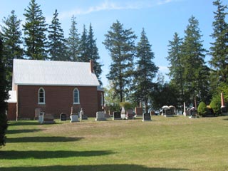
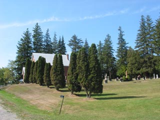
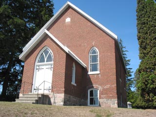
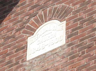
Breadalbane Cemetery
| Description |
|
|||||
|
A churchyard in the village of Utica. Next to Breadalbane church. This small ‘kirk’ was built in 1849 by original Scottish settlers in the Utica area. It has been closed since 1939. |
||||||
| Directions to Cemetery | ||||||
|
Lot 6, Concession 5 of the former Reach Township. GPS 44.06774, -79.0292 (DMS N44.04.073 W079 01.725) |
||||||
| Transcription Purchase Information | ||||||
| Transcriptions of the cemeteries in Durham Region are available for digital download from the Ontario Ancestors Marketplace. |
||||||
| Available Transcriptions | ||||||
|
An on-line index is available for those titles which are underlined.
|